Southwest Oklahoma Adventure (Post #731-733) March 2026

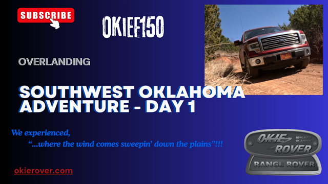
Southwest Oklahoma Adventure Day 1 (Post #728) 3/30/2026

Day 1.

Day 1 of our trip started with us heading down the blacktop toward Sandy Sanders WMA in Southwest Oklahoma. Our first stop was a the Dinosaur Space Rocket that Larry and Mark named Sticker Dinosaur Space Rocket due to the amount of goat heads in the yard in front of the site. You can find it on Roadside America. Unfortunately I couldn’t get the camera working for this attraction.

We took a hard right at Rush Springs, Oklahoma and took to the Wichita Overland Adventure Trail. I highly recommend this route. We drove around and looked at some neighborhoods down there in the Wichita Mountains.

We also stumbled on Mountain Park WMA. This is a wetland and famous for its hunting. It should also be famous for being a wetland in basically a desert. At some point during our chatting I mentioned Cry Baby Bridge in Blanchard, Oklahoma. 35.174555, -97.635488

A list of the “other” Cry Baby Bridges in Oklahoma.

We mapped out a path to “Devil’s Canyon” but we didn’t have a route to travel it in our vehicles. We kept going to Sandy Sanders.

We arrived and drove through the park. We were dealing with 35mph winds with gusts in the 50mph range. There were no camping areas with any kind of break from the wind.

We drove through experiencing some extremes we were quite frankly surprised our crew cab pickups could handle. We did a down angle of 22 degrees on one plunge. We had some off camber turns at 13 degrees. We also had some climbs in the 17 degree range. All in all we had fun.

With temperatures at 100°F (37°C) it was what I consider… SUMMER CAMPING.

I do not “Summer Camp”.

We decided to head to Lake Hall to try and get out of the wind. We were successful, but the temps were still too high for comfortable sleeping. It was 80°F at 11:00pm. Winds were still 20-30mph from the south.

At 0300 the wind changed direction and blew from the North at the same speed as the earlier winds that day. That cooled things off quite a bit. Down to 44°F with a windchill making it feel like 37°F. This was debated as the most extreme weather change our hapless group had ever experienced.

I took the lead for the second day and headed us toward the Antelope Hills and our final destination for Day 2, Packsaddle WMA.

Day 1 Wrap-up

I found some video on the B-roll camera I thought I’d also share. We just BS about the day’s events and take a look at our camping accommodations.

https://youtu.be/pnf9IE0GhBw

Day 2

We headed north to Antelope Hills. That was pretty great find. We did not see any antelope but deer were prevalent. Along with the wind…

Apparently the Texas Rangers had ventured there in the 1850s to battle the Comanches. Here are a couple of links to what happened.

Oklahoma Historical Society and Battle of Little Robe Creek.

We then headed straight for Packsaddle WMA. Again, the winds were silly strong. We hit all the roads we were allowed to travel. This would be quite the driving park if the roads reserved to the oil companies were open to the public. This was pretty disappointing. I get it, no one wants anyone messing with well heads. But this was a very unique site.

It also did NOT have any locations out of the wind. We finally found a site on the east side that offered a little and I mean little bit of wind break. The good news for us as the evening winded down so did the winds.

A negative for the site, all the camping areas were overrun with goat heads. Everything that touched the ground became covered in stickers. I’m not sure anything could be done about that, but wish there was.

We found an old school on 1890 Road, but I could not find anything online about the building. It could be Lone Bell school. It was an obvious school and may have served as a home in it’s later life.

We settled in to a chilly night with a moon dominating the sky and coyotes howling all night.

https://youtu.be/sSjCMUJyqEk

Day 3

We got a late start, on our third day. We are just three over 60 fellows. We are low-drag and never really in a hurry. Breakfast is our first thing each day and we take our time getting it done. Can we move faster… sure, but why? Part of the fun is not living by any agenda. Hell we barely prepare where we go, let alone keep a daily schedule.

We head east to close the distance to home. We headed to Burns Flat to check out the Oklahoma Spaceport. First and foremost, I bet your state doesn’t have a spaceport! So shut it. We have a spaceport, but it wasn’t without its controversies. Cost overruns, lack of any “real” progress, visitors from outerspace showing up without invitations, no cool yard art like rockets, or piles of debris from failed attempts to reach the stars. In the video I called it a “boondoggle“.

We then hit the blacktop to make some time to our final campsite. We stopped in Bessie (my adopted maternal grandmother’s moniker), Corn, Colony, and Sickles. Corn had a cool museum on the main drag. I got some video of that. It also had an old Jeep pickup like fellow former YouTuber and Okierover subscriber Tumbleweed Garage.

We pulled into Red Rock Canyon for our overnight camping. If you haven’t visited this gem, you should. First and foremost it is family friendly. It also has bathrooms and showers, perfect after a few days on the road. Campsites are everything from primitive to powered to rentable Yurts! What?!?

We were able to have a fire so I harvested some downed wood and we enjoyed a fire. Fires were IMPOSSIBLE at our other campsites due to the winds we experienced. We ended our trip here and headed back home to loved ones and civilizations and schedules.

Thanks for reading and Happy F150ing?…. Happy Rovering too…

Video coming.

Medical Issues (Post #718) 10/10/2025

Well…I’ve been away. Maybe you noticed. I’ve had some medical issues this September. I’ve had some issues that first looked like a back injury. I thought I was getting better but then I took an overland trip. Mr. Fisher and Mr. Obermiller and I took in a couple of sections of the Oklahoma Adventure Trail. The goal was to overland toward the Northeast part of the state to attend the Overland Expo in Jay, Oklahoma.

The trip was good. Lots of gravel roads. One section was pretty rough and was more like rock crawling. We slowed down to 5mph to keep from rattling the body panels off. We had a plan to get to Mr. Fisher’s friend’s lake house. It was real nice of him to offer us his house.

The heat was a little extreme for September in Oklahoma. Sleeping in air conditioning was far better than sweating it out in a tent. The temps on Friday hit 100°F (37°C), needless to say it was toasty. We slept well and headed to the expo on Friday. We saw some cool gear, shot some silenced weapons and had a food truck lunch.

It was about lunch time that the pain I was experiencing started ramping up. It migrated into my abdomen and was quite painful. Think 5 or 6 on the pain scale. Very unpleasant.

I tried several things and in the end I decided it was best for me to try and make it home before it got any worse. I spent the weekend and Monday on a heating pad living my best life through chemistry.

My concern was I was not getting any better. So a few doctor visits and we still don’t know exactly what’s going on. As of this post I’m about 90% sure I have a hernia of some kind or other. We’ll know more after the radiologist gets back to me.

May the winds take your troubles away, thanks for reading and Happy Rovering.

https://youtu.be/GFUQVd7KY20

The Eclipse (Post #650) 4/12/2024

Thumbnail

Unless you just crawled out from under a rock or came down from a cave in the mountains you probably know there was an eclipse on April 8th, 2024. I told Mr. Fisher and our newest add on Mark Obermiller that we had to go see it. So…we did.

Let’s talk a little about comms first. All three of us got our GMRS licenses prior to the trip. Mr. Fisher splurged and bought several radios.

First was the Midland GXT1000X3VP4

My personal experience with it? Battery life A-. We used them while we were driving for 6 hours. The knock on it was the battery life indicator showed full, right up to the moment it died. That’s pretty disappointing. Sound quality, B-, they were scratchy at the beginning of each transmission. We didn’t really test how many “far’s” it would work but a mile they seemed to work okay. Three pack for $99.00(US). That’s an inexpensive option.

The Second was the Rugged GMR-2 Plus

Mr. Fisher used this one when his other died. It took him a bit to program and his main complaint was getting it setup. We also were broadcasting on Channel 19 privacy 19. But on this radio the display showed channel 19 privacy 10. Not sure about that. Two for $150.00(US)

We’ll have more to say about these and others as we get further into GMRS. Almost all the options for GMRS radios are made in China. There are some made in Japan.

I did fiddle-fart around a little bit and didn’t bother to secure a campsite. Thankfully my friends at Fort Towson were hosting a Eclipse Watch Party. They consider me family, mostly because I visit them with my 1820-1840 Cherokee living history presentation.

We started out on Saturday morning. Mr. Fisher had plotted our route and I fell in behind him and Mark. Our first stop was Lexington Wildlife Management Area. This is a public hunting and fishing area in Slaughterville, Oklahoma. If you watch my videos, you may have seen a sign in my shoppe. Look for it next time. I have a creepy Slaughterville story, so ask me some time we are around a campfire.

We saw some fun stuff along the way including this moderate sized snapping turtle. Which apparently I can’t add a photo of right now. Thanks Google Photos, good work.

We drove around visited the Lake. My camera didn’t record while we were at the lake. Bummer cause we had some fun stuff to say.

Mr. Fisher’s remainder of his route had us weaving through to the Atoka Wildlife Management Area.

The wind was blowing pretty hard 20-25mph with gusts to 30mph. We looked around a bit to find a campsite. We started where you see above but also went down to the lake shore but the site was too windy. With Mr. Fisher and Mark in tents, that wasn’t ideal. I went around to the opposite side of the lake but there wasn’t a suitable site over there either. We’ll be back to this site another time.

We setup camp and had some delicious sirloin steak, fried potatoes, and yeast rolls. Dessert was cookies. We had some adult beverages and started a small fire. We were expecting storms and they did not disappoint. We had a nice gust front hit us and then the rain started. I ducked into the F150 and they to their tents.

We rode out the weather which turned out to not be all that impressive. Considering I’ve slept through two near misses with tornadoes, once outside Kansas City dressed for 1750s living history where I slept in a wickiup and the second I was in the back of the Big White Bus at American Horse Lake, this one barely rates mention.

It was my turn to lead so I used Gaia to map out a route. I didn’t have as much trouble mapping as I did when I tried to use the PC. At this point, if it doesn’t get better I’ll probably cancel. I need to try the Overland Bound app.

We had a mostly uneventful second leg. That is until we were traversing what we call a “jog” in the road. This one made a right and then an immediate left all on a 10% or greater grade. There were some brick-sized rocks. Mark must have caught one just right because it separated and cut the tread on one of his Wrangler SR tires. Not necessarily rated for “trail” running but I didn’t think they would fail.

Without a spare we got back on the pavement to avoid another incident. We didn’t have another tire and it was a Sunday so better safe than sorry.

We arrived at Fort Towson and setup came while I found my friends and said hello. We cooked dinner and got setup for the night. They had a nice spread and we had some delicious food. Homemade cinnamon rolls really finished the night off right.

We were tasked with parking duty. We had a good time and welcomed everyone. I shared some fort history to those who hadn’t researched it themselves. All in all we parked around 75-100 cars and roughly 375 people came to watch.

The clouds were sparse early but built up more and more as the day went on. It was looking like we weren’t going to see the eclipse. But just as one of the guest said the parting of the clouds would occur and just in time.

There are no words to describe the eclipse. It was in the top 5 events I’ve ever attended. The light right before the eclipse was eerie. It was like an old Argon street light. Such a special event. Seeing the ring, seeing the solar prominence, it getting dark right in the middle of the day. Birds stopped singing, a tree frog croaked, basically nature thought it was night. I said “so cool” about a dozen times during my video. Like I said, there were no words.

The fort staff set off a cannon during the totality.

They say the next one is in August of 2045. I’ll be 80 years old. The path will go right through Oklahoma. If I’m still residing in Newcastle, I’ll only need to drive 75 miles to be in the center of the totality.

I hope you enjoy the video. I know it is a bit long, but it was a big weekend.

Like and subscribe to the blog and the YouTube channel if you see fit. I would really appreciate it.

I have a Patreon account setup if you would like to help with the cost of keeping this website up. Okierover Patreon.

Thanks for reading and Happy Rovering (of F150-ing if your Land Rover is in a shoppe).

Among the Gourds and Gravel (Post #574) 7/3/2017

In all my 50+ plus years of living in Oklahoma I have never been to the top of Mount Scott. So this past weekend, I took off to see it. Mount Scott is located in the Wichita Mountain Wildlife Refuge near Lawton, Oklahoma. It rises to 2,464 feet above sea level and towers over the surrounding area. There is a three-mile long road that takes you to the top.

Continue reading “Among the Gourds and Gravel (Post #574) 7/3/2017”

Osage Adventure (Post #554) 1/30/2016

20160123_081651

I got together with some fellow Oklahoma Land Rovers Owner members and went on a tour of the Oklahoma Adventure Trail. If you haven’t looked this up on the internet yet, you should. It will be the source of several trips for the Big White Bus in the coming year.

Oklahoma Adventure Trail Facebook.

Oklahoma Adventure Trail Website.

Nathan brought his “new” Range Rover. I was in my Range Rover Classic. John and Jayden were in their Discovery. And Erik and David were in the Defender.

John planned our trip and did a great job of mapping out some fun places to see and giving us a great tour of the back roads of Logan, Lincoln, Creek, Payne, and Osage counties. You will find the links to the map used to guide us. There were deviations from these maps but once you are out there you’ll realize why. Fair warning this is a picture heavy post.

20160123_092542
One of many trestle bridges we encountered.

We drove along the Cimarron River for a good stretch.

Supports for a bridge that is no longer present.

20160123_093641
Along the Cimarron River

This is where we learned Erik lost his gas cap on his Defender. He made a “field expedient” cap out of some duct tape.

We detoured as suggest up to the town of Ingalls, Oklahoma. The town was the scene of what is called the “Battle of Ingalls”. The fight was between U.S. Marshalls and the Doolin-Dalton gang. You can read more about it on Wikipedia or on Legends of America. We stopped and took pictures of some seemingly old buildings, one of which seemed original to the time. We went down the street and to the site of the fight. None of the original buildings exist today.

We headed down the road and eventually turned North toward Osage County. The Oklahoma Adventure Trail lists the roads and the detours. Those detours were often buried in posts and therefore sometimes we didn’t know of a bridge out. Of course when you are driving a Land Rover a detour is not always a detour. In this case it was, the bridge was out over a very deep creek.

There were no shortage of bridges to cross. This one was a Works Project Administration job from 1940. They provide a nice break water that had a waterfall.

20160123_105024

We stopped in Cleveland for lunch and fuel. We pulled into town on Hwy 64 and stopped at the Dollar General next to the McDonald’s. There was no way I was eating McDonald’s unless there was nothing else. Thankfully we saw Rosie’s Tacos when we crossed the lake south of town on Hwy 64. Yes, that’s a car port. Yes, that’s a trailer parked under it. Trust us. Erik made the first suggestion that he was going to take the gastronomic adventure and get some chow there.

That was all the suggestion I needed. I didn’t have tacos. I had tamales. Delicious. Their verde’ sauce was just the right amount of hot with flavor. I’d drive back there again just to eat the tamales.

Rosie's Tacos
Rosie’s Tacos. Yummo.

My odometer rounded out to 237,000 as we pulled up for petrol.

20160123_121613
My plastic needs a clean and a new coat of paint.

So with both our tanks and our bellies full of goodness we headed for the Osage Tallgrass.

We got to Barnsdall, Oklahoma where we encountered the only oil well in the world located on a city street. You can see it if you navigate here. 36°33′41.93″N96°9′56.57″W

20160123_131335
I was a little surprised it didn’t get rammed by cars more often.

We knocked around a few more locations. Coming out of the Hulah Wildlife Refuge, at least I think it was the Hulah WR, John and his Discovery started having death wobble. We limped along until we got back to the highway going into Bartlesville.

Once stopped, we tried to sort out the issue. At one point John explained how we could deviate our path and call it a night.

John, “We can stay on the black top roads.”

David, the single gentleman of color in our group, interjected, “Why do they have to be ‘black’?”

I couldn’t help myself and had to add, “Because black top roads matter.”

Everyone laughed. It was the levity the trip needed after a long day on the dusty back roads and an unfortunate break down.

Death wobble west of Bartlesville

We tried swapping John’s spare when I noticed that one of the balancing weights was missing from the last stop. Getting the tires balanced is the first thing done to solve an issue with death wobble. Unfortunately that didn’t work.

With the daylight quickly waning, we decided to get the Disco into town. John knew of a grocery store at the bottom of the last hill going into Bartlesville. Once he hit the hill he put the Disco in neutral and coasted her down. We did some additional investigating which did not result in a solution to the problem.

Field repair in a grocery parking lot

We decided to head for the camp site as it began to get dark. When John was planning the trip he remembered a Boy Scout camp and lined us up with one of the cabins. Camp McClintock BSA.

Camp McClintock "Cubs" Cabin. They even provide cots for those of who didn't bring one.
Camp McClintock “Cubs” Cabin. They even provide cots for those of who didn’t bring one.

Once we got the fireplace glowing it took the edge off the night and made for a very tolerable sleeping experience. David was the man when it came to getting the fire going, well done sir. Each person was responsible for their dinner and those who were cooking got started and we had a great discussion.

We spent the evening discussing cars we’ve owned, some sea stories from serving the Marine Corps, and even politics. That may have been the most civil political discussion I’ve ever been a part of. I pretty sure both ends of the political spectrum were represented. One theme emerged, no one was happy with how the country is being governed by the legislative and executive branches.

The next morning we cleaned up the cabin and went for a short hike to the suspended cable bridge. Very interesting.

We went across the creek to a pond on the other side. It was partially frozen. It didn’t take us long to start skipping rocks and sticks across. The ice and the debris we tossed across it made one of the coolest sounds you’ll ever hear in nature. You can read about it here and see a video about why you get that sound.

We hiked back to the cabin where we decided to part company. Erik and Nathan would take off for OKC and I would take John back to his Disco and get it up on the trailer his dad had left that morning to assist in recovery. After we got her up on the trailer we decided to take in a bit more of the OAT on our way home. we weren’t to adventurous being as we were alone and had no hope of a timely recovery if we got stuck.

We took a detour off the OAT to see “Frog Rock”. It over looks a nice valley and was in a very remote location. When I climbed up behind the rock to take a picture of the valley I accidentally found a Geocache. We left a note that we were there for the next person to find. We didn’t take anything and we didn’t leave anything either.

I’ll leave you with a gallery of the better shots. Click for full size.

If you are interested in driving where we drove John provided the following maps. We must say we didn’t follow them “exactly”. We took the roads that interested us the most and if there was water crossing we took it.

Osage County Eastern Loop 1

Osage County Eastern Loop 2

Osage County Eastern Loop 3

Osage County Eastern Loop 4

Once again and as always, thanks for reading and Happy Rovering.

SORRE, No Wine and Cheese… (Post #553) 1/20/2016

Head

A new club is in the works, Southwest Off-Road Rover Excursions. Their website is up check it out here.

We are an off-road group in North Texas, Oklahoma and Arkansas that is interested in camping and driving off-road.
No group officers, no dues, no restrictive rules, no wine and cheese tastings …..just good times camping and Rovers. If this sounds fun to you then join up.

I’m signed up. What’s stopping you? You can also check them out on their Facebook page.

I think it will be fun to bring wine and cheese to the first outing just for a giggle. Just kidding.

wreck.jpg

I have some bad news about the Big White Bus. She was rear-ended while parked on the street outside my uncle’s retirement home. When the dust settles I’ll let you know more. Suffice to say I can still drive her and plan to make the trip this weekend to drive a section of the Oklahoma Adventure Trail. We are going up to the Osage country. There is still time to meet up. Details are on the Oklahoma Land Rovers Owners Facebook page. Hope to see you there.

Thanks for reading and Happy Rovering.